
Date: 13/08/2014
Mt. Maroon is part of the Mt. Barney N.P. and is located near Rathdowney, South of Brisbane. The Ekka holiday was once again upon us and, as usual, rather than deal with the hordes at the show I decided to head out for a walk. Mt. Maroon provides stunning views over the district and some of the most interesting geological formations in S.E. Queensland.
The walking track is well used and as with all parks in the area, the start of the walk is now marked by a boot cleaning station. Be sure to use these stations as National Parks tries to stop the spread of the root destroying fungus Phytopthera Cinnamomi.
As soon as you leave the car park the track starts up hill, leading at first through cleared farm land before you reach the edge of the National Park itself and the ridge that will take you most of the way up the mountain. The track is rough and there is no room for grading on the narrow ridge so make sure you are prepared to get the blood pumping.


Examples of the track early on in the climb
I was with an old friend, but new walking companion for the day and the steepness was seemingly reduced and the distance compressed by the good conversation and numerous vantage points providing views to the North and North-East and across to the rocky North-North-Easterly ridge.


Views back down the ridge and the track. Are we having fun yet???
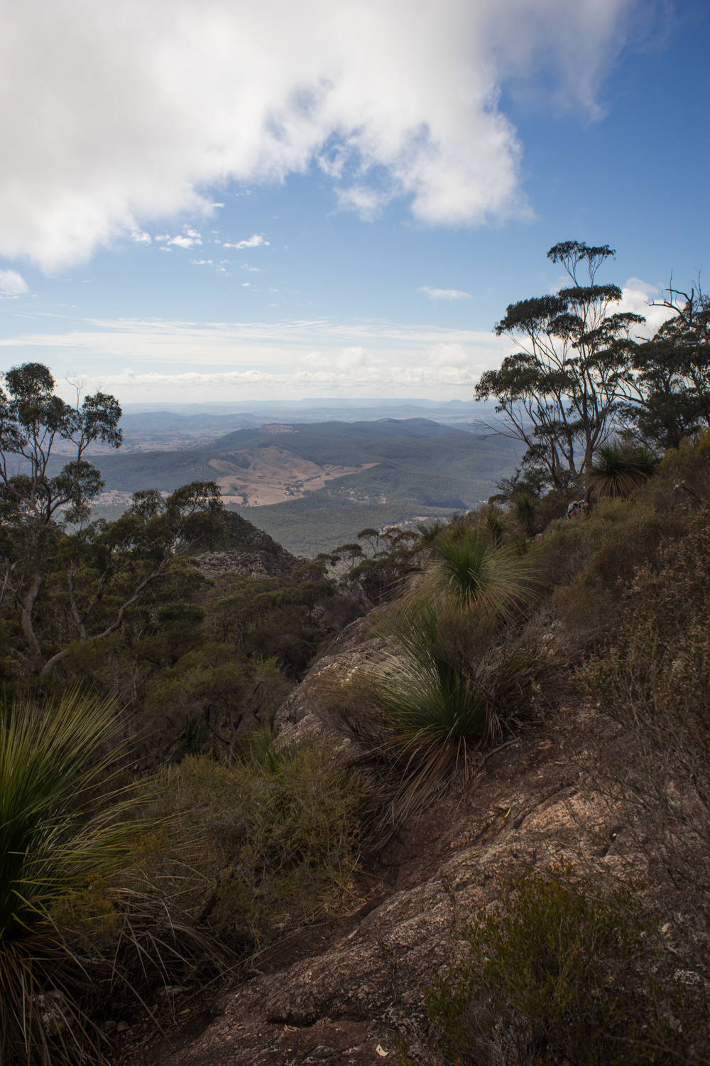
Before long we reached morning tea rock, an exposed outcrop providing unobstructed views across to the other ridge and out across the farming land below. The weather was glorious and the steady breeze cooled us quickly once stopped.
It is from this viewpoint that we got our first good look at the amazing vertical Trachyte formations. Mt. Maroon is part of the remnants of the large Focal Peak Shield Volcano that erupted 24 million years ago. More information of the geology of the area can be found in this document released by the Geological Society of Australia.

 |
| Looking up the gully towards the Northern Peak |
 |
| The gully section of the track |
Once the track flattens keep an eye out for a branch off to the left. This takes you to a large rock shelf with excellent views towards both summits and the East face. Climbing parties can often be seen on the popular route Ruby of India which heads up the right hand side of the face.
 |
| View to the North from the rock shelf |
 |
| Large summit cairn |
 |
| Sneaky Grey Shike-thrush on the summit. Lake Maroon and the Main Range in the background. |
 |
| Mt. Lindsay and Mt. Barney |
Other walks in the area:
- Mt. Barney: Lower Portals
- Mt. Barney: South Ridge
No comments:
Post a Comment