We started with the park. Chosen because Maree had never visited Conondale, and I knew that the type of walking would provide some relief from the rapidly approaching hot weather. Second was the journey and other activities. We wanted to walk up the creek for the opportunities that it would provide for photography and swimming. Finally, the destination of Artists Cascades was a worthy one and the walking track that also passes this spot would provide an alternate route back to the car.
My hiking, climbing and camping adventures in South-East Queensland (and beyond)
Showing posts with label Day Walks. Show all posts
Monday, 17 November 2014
Artists Cascades (The Slow Way)
Tuesday, 30 September 2014
Mt. Greville: Waterfall Gorge
![]() |
Mt. Greville |
Here's a walk that I never got around to posting from last year. Directions for getting to the carpark of Mt. Greville and the start of the track can be found in my previous report about Palm Gorge here. Ever since completing that first walk Mt. Greville has been a bit of a favourite location of mine. I've since taken some family up Palm Gorge and have been back a couple of times rock climbing in Waterfall Gorge. However, until this point I still hadn't been all the way up via this route.
Saturday, 16 August 2014
Mt. Maroon
Date: 13/08/2014
Mt. Maroon is part of the Mt. Barney N.P. and is located near Rathdowney, South of Brisbane. The Ekka holiday was once again upon us and, as usual, rather than deal with the hordes at the show I decided to head out for a walk. Mt. Maroon provides stunning views over the district and some of the most interesting geological formations in S.E. Queensland.
Friday, 16 May 2014
Gwongoorool Pool
Date: 25 April 2014
Gwongoorool Pool is located on the Upper Coomera River within Lamington N.P. in the Gold Coast Hinterland. If you're after a swim in beautiful crystal clear pools with perfect stoney beds then this could be the walk for you. Just watch out for the eel!
Labels:
Binna Burra,
Coomera River,
Day Walks,
Gwongoorool Pool,
Lamington NP
Monday, 5 May 2014
Gap Creek Falls
Date: 13 April 2014
One of the last remaining track walks starting from Cunningham's Gap that Maree and I were yet to do was to Gap Creek Falls. I guess the thought of driving up the range only to walk back down again just never appealed to us. However, with overcast weather and cloud covering all the peaks we decided it was a good day to head down the range.
Wednesday, 5 February 2014
Cedar Creek Falls
Date: 2 Feb 2014
This past weekend we headed to the D'Aguilar National Park to do an off track walk along Cedar Creek. I say off track because there are no formal markings, however it is extremely hard to get lost while following the creek as it is wide and rocky for most of the way.
Wednesday, 29 January 2014
Purling Brook Falls
Date: 31/12/2013
Some bushwalks are popular for a reason. Often because the spectacular view to effort required to get there ratio is fairly high. The Purling Brook Falls walk in Springbrook N.P. definitely fills this quota. The falls themselves can be viewed from a lookout easily accessible from the carpark along a concrete path. However, things only get better as the walk progresses and to answer the question of one walker heading in the opposite direction as we were heading back up the hill... "Yes it is worth going down there".
Tuesday, 26 November 2013
No Excuses
There really is no excuse for not getting out in the bush in S.E. Queensland when it is just so damn easy. Well, except for maybe the odd hail storm or two that we've had lately.
This past weekend Maree and I decided to head to the J.C. Slaughter Falls picnic area to fit in a quick walk between other engagements. This is part of the Mt Coot-tha Reserve which is maintained by the Brisbane City Council (more information here). We decided to head up Ithaca Creek to try and get away from most of the crowds, so started on the summit track but headed up stream as soon as we hit the creek.
Spikey grass trees along the creek |
Tuesday, 17 September 2013
A New Perspective on Girraween
Date: 5 - 8 September 2013
Those who have kept an eye on this blog will probably have realised by now that Girraween is a favourite place of mine. This time a birthday trip was on the cards so Maree and I took a couple of days off work to make it a super long weekend, invited a few friends and off we went.
Thursday, 15 August 2013
Goolman Lookout
![]() |
Hardings Paddock Picnic Area |
Having been very busy working on the house recently I was glad to get out for a leisurely walk on the Ekka public holiday. Maree gave me the idea of heading to the Hardings Paddock picnic area within the Flinders-Goolman Conservation Estate as she was out there last week for work. We had previously done the Flinders Peak walk and at the time noted some of the other smaller peaks in the region but never had a chance to go back.
Tuesday, 28 May 2013
Another Week in Tasmania
Date: 14 - 22 April 2013
As mentioned in my previous post, I managed to get down to Tassy twice this year and this would be my second trip. This time was for my honeymoon with my beautiful wife Maree and once again The Apple Isle didn't dissapoint. The itinerary for the trip included Freycinet Peninsular (again), Tasman Peninsular, Bruny Island and Hobart.
Tuesday, 23 April 2013
Two Weeks in Tasmania
Date: 23 February - 10 March 2013
I first visited Tasmania in 2008 with Maree. We spent a week touring in a campervan and we loved the place. I've been wanting to get back there ever since and this year I'll be lucky enough to get down there twice. The first trip was with Tom and we spent two weeks walking and climbing at Ben Lomond, Freycinet Peninsula and Mt. Field.
Note: As usual be sure to click on the photos to see the full resolution version. They come out a bit blurry when reduced in size.
Note 2: This is a fairly extended trip report so it might be best to grab a coffee first. ;)
Tuesday, 4 September 2012
Girraween in July
![]() |
New Boots (16) with Wattles at Turtle Rock |
After a busy first half of the year I was really looking forward to a bit of time off from work. The frequency of my bushwalking posts has diminished this year mainly because the majority of my spare time has been taken up with rock climbing instead. It is just another way to enjoy the bush and the outdoors and often includes walking as well. So basically it's win win as far as I'm concerned.
So during the last week of July, Tom and I decided to get in a solid few days of climbing at one of our favourite places no matter what the activity: Girraween.
Tuesday, 12 June 2012
Mt. Matheson Circuit
Date: 9th June 2012
Looking to make the most of the long weekend Maree and I decided to head out for a walk. We decided on a circuit starting at Spicers Gap on the Main Range heading up Mt. Matheson. The walk started from the picnic ground next to the Spicers Gap campsite and was built by the National Parks Association. The track is nice and wide most of the way and had some really interesting features and a different outlook of the surrounding area.
Mt. Cougal
Date: 6 April 2012
This walk had been mentioned numerous times on the bushwalking forums and the views had always looked great so we finally got a chance to do this in April. The drive from Brisbane took a while but once you leave the highway and head into the Currumbin Valley it is very pleasant.
Starting up hill immediately the walk follows the border fence nearly the entire way to the peak of the mountain, making route finding extremely easy. The track wasn't maintained though and the first section passes through some very overgrown grassy sections covered in cobblers pegs. I would recommend wearing full gaiters.
Before long you are greeted with some great views back up the valley and across to Mt. Cougal and Mt. Tallebudgera
This walk had been mentioned numerous times on the bushwalking forums and the views had always looked great so we finally got a chance to do this in April. The drive from Brisbane took a while but once you leave the highway and head into the Currumbin Valley it is very pleasant.
Starting up hill immediately the walk follows the border fence nearly the entire way to the peak of the mountain, making route finding extremely easy. The track wasn't maintained though and the first section passes through some very overgrown grassy sections covered in cobblers pegs. I would recommend wearing full gaiters.
Overgrown track |
![]() |
First view of Mt. Cougal and up Currumbin Valley |
Tuesday, 13 December 2011
Binna Burra: Lower Belbird Circuit
![]() |
Looking across to Ships Stern |
After having our Girraween trip cut short by rain the week before we wanted to get out for another walk while we were still on holidays. Trying to avoid the heat somewhat we headed for higher altitude and shady rainforest at Binna Burra. We decided on the Lower Belbird Circuit which I remembered as a highlight of the Gold Coast Hinterland Great Walk.
Tuesday, 4 October 2011
Flinders Peak
![]() |
Flinders Peak Pano |
View towards the Great Dividing Range |
Flower at the peak |
View to the North-West |
Sunday, 11 September 2011
Cold, Windy but Beautiful at Girraween
Date: 10 - 11 Sep 2011
Day 1:
![]() |
Main Range at Sunrise from the Highway |
By 10:00 we were set up and ready to go. The plan for the day was to head out to The Sphinx and Turtle Rock to investigate the climbing opportunities there. The track heads off from the Southern End of the campsite and is also the starting point for the Mt. Norman and Castle Rock walks. The walking was extremely pleasant with the clouds clearing to a beautiful day and the good quality track providing easy walking up a gradual incline for most of the way. The only downside was the wind which was gusting to around 30 to 40KM/H.
Thursday, 23 June 2011
Mt. Greville
Date: 19/6/2011
Walkers: Maree, Myself
Walk Description:
Ever since walking up Mt. Edwards last year I had wanted to get out to the slightly more impressive Mt. Greville. Standing at 770m it is one of the tallest of the Moogerah Peaks. We were following track notes from Take a Walk in S.E. Qld and at the end of the day were very happy with the route, which provided the best directions of travel for the views and terrain we encountered.
The trip from Ipswich took roughly an hour and a half with a breakfast stop along the way. The entrance to the National Park is on the South-East side of the mountain and consists of a small grassy carpark. After making some final gear adjustments we set off along the track following signs for Palm Gorge. This first section of the track followed an old management road beside a fence line until it eventually veered off to the right along a narrower foot pad.
Massive Palms in the Gorge |
The vegetation became very lush as we headed up hill and we could gradually see the walls of the gorge closing in until eventually its width would have been less than ten metres across. The name of the gorge was well deserved with numerous palm trees all stretching as high as they could to catch the sunlight at the top of the cliffs. The ground was very rocky and covered with palm fronds making progress slow in some sections. The gradient was reasonably steep and consistent most of the way up the gorge until we reached its head and the main track junction for the other routes up.
This fella was bigger than my hand. Some sort of Golden Orb? |
Narrow Section of the Gorge |
From here the vegetation dried out and more low shrubs crowded the track. Within a few minutes we reached a short side-track off to the left which gave us a good view towards the Main Range from the top of a steep rocky gully. After returning to the track we continued upwards towards the peak. The number of grass trees increased as we climbed higher and after negotiating a few steep sections of the track we reached the large cairn marking the peak. Views from the peak were largely obstructed by trees, however as the notes instructed there were great views from a rocky outcrop to the West.
Mt. Edwards & Lake Moogerah from the Peak |
Grass Tree Flowers |
After taking some photo’s we chose a rock each and had lunch before heading back the way we’d come. When we reached the junction at the top of the gorge we took the other option which headed towards the top of the South-East Ridge and our route down. The foot pad down this section wasn’t always obvious because of the large amount of rock slabs but the ridge was fairly easy to follow and provided a stark contrast to the track we’d taken on the way up. There were plenty of views across to Mt. Moon, the Main Range and even all the way through to Mt. Barney. The gradient was fairly easy going most of the way down except for one steep, loose and rocky section.
South-East Ridge |
Before long we had reached the main track junction again and it was only another couple of hundred metres back to the car. Overall I’d rate this as one of my favourite day walks in S.E. Queensland so far. The variation and uniqueness of the terrain and foliage within the one walk was amazing and I will definitely be heading back to explore Waterfall Gorge.
Mt. Greville |
Sunday, 8 May 2011
Mt. Cordeaux & Bare Rock
![]() |
Mt. Cordeaux Peak from the Lookout |
Walkers: Maree, Myself
Walk Description:
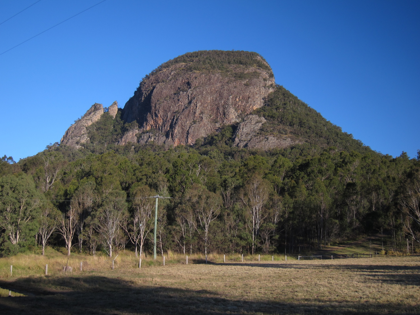
Mt. Cordeaux, along with Mt. Mitchell, are the two peaks that stand over each side of Cunningham's Gap in the Main Range National Park. With a stunning Autumn day the decision to head out for a walk was extremely easy to make. The drive from Ipswich took about an hour and we arrived at the top of the gap by about 10AM. This was despite the large road works heading up the range reducing the traffic down to one lane.
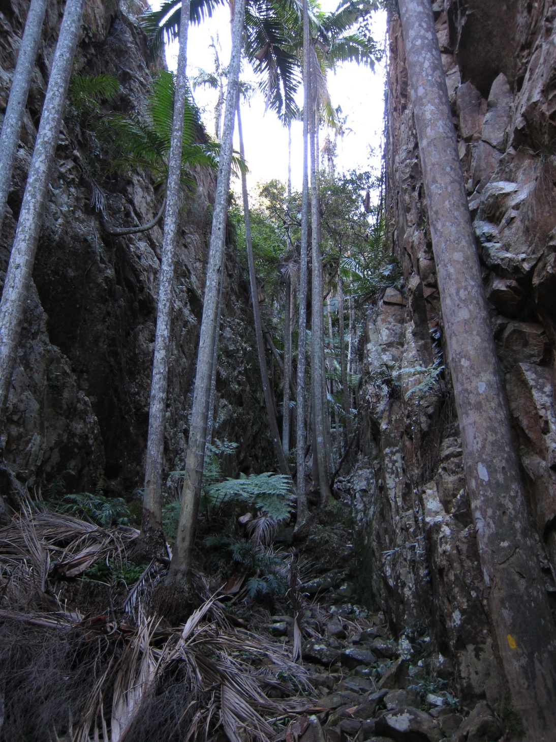
The temperature was much cooler up in the shade of the rainforest so we were keen to get going and warm ourselves up. The track started along the Rainforest Circuit at an easy uphill gradient and it wasn't long until we were greeted with a familiar panorama from the first lookout to the East. From here we continued along the rainforest circuit until we reached the track junction to divert us to our destination of Mt. Cordeaux and Bare Rock.
From here the track continued steadily uphill as we tracked North-West along the side of the moutain before switching back and heading towards the peak lookout. As the track climbed higher there were some great views to the South, showing us a different aspect of Mt. Mitchell.
The vegetation on the more exposed slopes in this section had opened up and comprised of a combination of low shrubs, grass trees and very large succulents. Throughout the walk there was also a large variety of mosses.
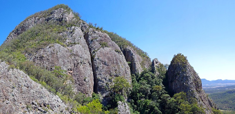
The Mt. Cordeaux lookout provided a near 360 degree view, only excluding the North-West to North region which was blocked by the peak itself. We arrived here by about 11:30 and stopped for morning tea before continuing on towards Bare Rock. The track detours around the Western side of the peak where you get a good view of the cliffs surrounding it. This is the reason that the track dosn't actually reach the true summit.
Mt. Cordeaux Peak from the North |
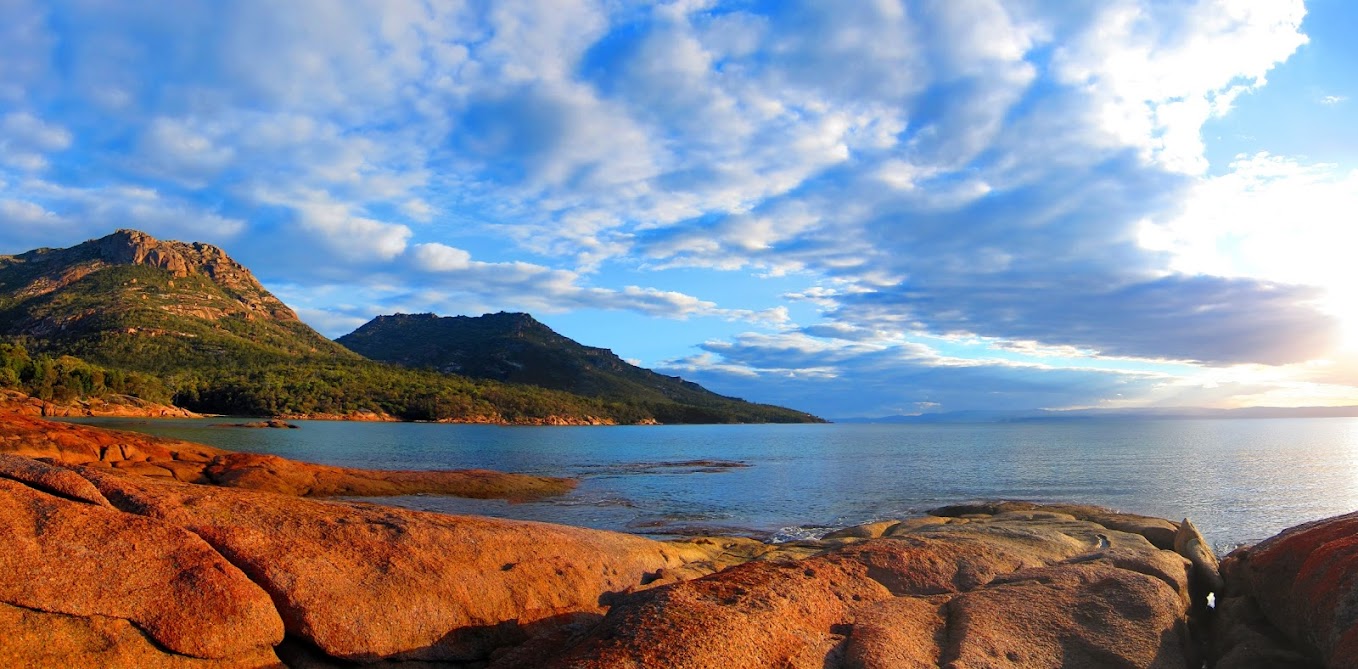
By contrast the view from Morgan's Lookout was fairly overgrown. We followed our same path back to the car except for a couple of stopover's and detours. The first was for a trip up to the peak of Mt. Cordeaux. The "Take a Walk" guidebook advised that the best way to attempt this was from the Northern end. I bush bashed my way to the base of the cliff line on the Western side and tracked North along the cliffs until I found a possible way up. It was a very steep scramble/climb and apart from the point of reaching the top, probably wasn't worth it. The top was mostly covered by vegetation and didn't provide any additional outlooks.
The only other variation we made on the return journey was to continue around the other half of the rainforest circuit. Great way to spend an amazing day.
Moss Covered Tree |
Subscribe to:
Posts (Atom)